The Winthrop Town Seal
Allan Forbes, Ralph Eastman, 1950
Town and City Seals of Massachusetts, pg. 137 | Internet Archive
One of the show places in Winthrop, known formerly as Pullen Poynte, is the ancient Deane Winthrop house once the residence of Deane, the son of Governor John Winthrop. The Secretary of the town's Centennial Celebration Committee, Sidvin Frank Tucker, explains the curious fact that this building erected about 1637 and without being moved, has been located at times in four different towns, in Boston from 1630 to 1739; then in Chelsea to the year 1846; then in North Chelsea (now Revere) to about 1852; and since then in Winthrop. He also reminds us that one of the Floyd family who was born in this house and for whom a street has been named, was correct when he stated that he had lived in three towns, yet never moved. Governor John Winthrop was the first white land owner and his son, Deane, the first permanent white resident. At Winthrop Head the Governor had his Signal House. |
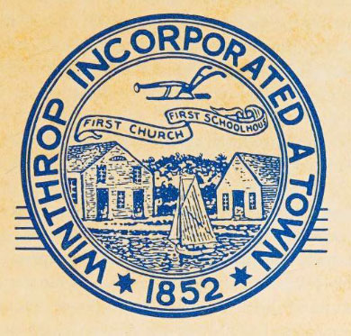
| In examining this seal, one would at first suppose that one of the two buildings reproduced is this Deane Winthrop house, but such is not the case, for the one on the left is the First Church and the one on the right is the very crude first School House. The former building shows the First Methodist Church, dating back to 1834, but it does not depict the fence upon which we are told it was customary for the men of the town to congregate before and after Church services, It has also been said that here, while seated on the railings, many local matters were settled by the Town's leaders, wearing the customary tall hats or that period. |
| The first school structure shown on the seal (located where is now the post-office) held only twenty-seven pupils, was heated by a small stove, and the record of the yearly expense of running it shows only $378. A plough is to be seen on the top of the seal, calling attention to the fact that Winthrop was predominantly a farming community, employing fifteen yoke or oxen. There was no horse kept in town until into the nineteenth century although Judge Sewall relates that Madame Paige drove down from Malden way in her chaise in 1704 to Deane Winthrop's funeral. There were only three streets until 1840, and in order to pass from one side of the town to the other, one had to open and shut, remove bars of, nine gates across the roads. In the foreground of the design is shown a fisheries scene, for that pursuit was carried on extensively at Point Shirley, named for the Governor. In fact, this pursuit might have been conducted almost anywhere along the eight mile stretch of coast line of the almost complete island. |
| An incident has been told which reminds us of the famous Bacchante statue which was ordered removed from Boston in 1896. Years ago one of the Belchers presented the Town of Winthrop with a watering trough surmounted by a large bronze statue of a female practically nude. The whole affair was set up in Columbia Square (now Metcalf Square) in the center of the Town. A good lady living near-by, objected to it because it lacked what she considered modesty. This caused the boys of the Town one Fourth of July night in the 1890's, to deck out the figure in a long flowing white nightshirt so the good people should be no longer shocked. The fountain and statue remained there for some time but a number of years ago, after the horses through drinking, “'Bacchante” was suddenly removed and is believed to be nestling somewhere in Winthrop in a dark storeroom. |
| An interesting feature concerning Winthrop centers around the forts which were believed necessary owing to the extent of its sea coast, and as a part Oo the protection of Boston. The earliest fort was erected in 1776 during the Revolution and was demolished in 1906, It was known as the Old Fort and stood in the rear of the site of the prescent Catholic Church at Point Shirley. It was built at the time of the Battle of Shirley Gut in 1776 in which Captain Mugford and others were killed, and about a year after the second battle of the Revolution which was fought at near-by Chelsea Creek in May, 1775. This early fort went by no name as far as can be learned, and there are no visible remains of it to be seen today. |
| Not far away from this location on Point Shirley were the fisheries of that day and later the Sturgis Salt Works. John Hancock had his summer home near here and, also, Mather Byles preached here. There is a legend that Shirley Gut in the early days was so wide that the Constitution was able to pass through. |
| Over a hundred years later, in 1890 or 1891, fortifications and barracks were begun on Fort Banks and very soon alter a fort was erected called Fort Heath. The former occupies a large area on Revere Street in Winthrop, It was named, of course, for Major General Nathaniel Banks of Civil War fame, and its story was given me by Lieutenant Colonel Arthur T. Dalton. This fort served as a Recruiting Station in 1917. During World War I it was manned by the old 13th Regiment of the Coast artillery and was Headquarters for all the forts in the outer arbor of Boston. During World War Il it was the Headquarters of part of the Eastern Sea Frontier and later served as an Induction Center. The U. S. Government map noted that mortar batteries were stationed here, A street near-by is called Banks Street. Just as this article is going to press it has been announced that the Department of Defense will dispose of this property and the town will probably purchase all or part in order to expand. |
| The rather dilapidated Fort Heath can be seen by following along Highland Avenue, past Floyd and Pond Streets, to Grover's Cliff which commands a fine position overlooking Broad Sound and the Atlantic Ocean. A map of the town speaks of this seventeen-acre Government Reservation as the "Gun Battery" at the time of purchase in 1900. Today it seems to be in a state of demolition but in earlier years it might have served its purpose very effectively. Mr. Channing Howard, a well known Boston engineer, believes that the first fort in the United States where disappearing guns were used was in Winthrop, Part of the acreage went on permit to the Navy as late as 1949. The fort was used for harbor defense purposes during both World Wars and had troops stationed thereon, but at no time saw any military action. The Massachusetts Institute of Technology gives us the information that it has conducted an active field station here. The work began during the war period and has continued up to the present time. The type of work at this station is not divulged. |
| This fort acquired its name from William Heath who was born at Roxbury. In 1761 he became a member of the General Court of Massachusetts, and taking an active part in the revolutionary movement became a member of the Committees of Safety and Correspondence. He was appointed in 1774 a brigadier general of militia, was present at Concord in 1775 and in the following year-was made a major general in the Continental Army, He took part in many battles until the war ended. Subsequently he became a member of the Massachusetts Convention, was a State Senator in 1791 and 1792 and in 1793 was appointed probate judge of Norfolk County. |
| Much of the information in regard to these forts was very kindly given us by Colonel Arthur S. Champeny through Major General Frank A. Keating of the Boston Army Base, and by Dr. F. L. Foster of the Massachusetts Institute of Technology. |
| As Deer Island now is connected to Winthrop by a road, we can be justified in adding Fort Dawes to our story of the Winthrop forts. It occupies about a hundred acres of the southern portion of this island and by a General Order issued by the War Department was given its name in honor of William Dawes, a fellow messenger with Paul Revere, but on a different route, on that memorable night of April 18, in 1775. William Dawes is said to have ridden farther than Paul Revere on that eventful night and the Dawes family believe that their ancestor has never received proper credit for his activity as contrasted with the prominence given to his associate, Revere. Some stanzas Composed by Helen F. More and sent to us by General Charles G, Dawes, touch upon this incident; |
When the lights from the Old North Church flashed out,
Paul Revere was waiting about,
But I was already on my way;
The shadows of night fell cold and grey
As I rode, with never a break or pause.
But what was the use, when my name was Dawes, |
History rings with his silvery name;
Closed to me are the portals of fame.
Had he been Dawes and I Revere
No one had heard of him, I fear,
No one had heard of mc because
He was Revere and I was Dawes, |
Tis all very well for the children to hear
Of the midnight ride or Paul Revere;
But why should my name be quite forgot
Who rode as boldly and well, God wot?
Why should I ask? The reason is clear;
My was Dawes and his Revere. |
| From Colonel Champeny we also learn that Fort Dawes was acquired by purchase in 1906 and the Adjutant General designated it as a sub-post of Fort Banks. Troops were stationed in the Fort, which was used for harbor defense purposes during both World Wars, but no military action took place thereon. Dr. Foster of Technology writes that there is no work going on at Fort Dawes now, but that there are undoubtedly some remains of the installations used during the last war. The Radiation Laboratory, pretty much the center of research in the field of radar during the war, had a field station there. These studies were of an experimental nature concerning microwaves and during the summer of 1944 a series of measurements of transmission over water was conducted. |
| Very recently, one of our Assistant Vice Presidents, C. W. Deasy, a resident of the town, visited these three forts now in existence and makes this report of their condition: |
| "At Fort Banks I talked with Captain Ringrose, who gave me the following information — |
| "At the present time there is a small detachment of approximately 300 officers and enlisted men stationed here, commanded by Colonel Shumate, a graduate of West Point. All the buildings are occupied for routine use and seem to be in very good condition, as is the whole reservation. |
| “The situation at Fort Heath is quite the reverse of Fort Banks, The place is in bad repair with the exception of four buildings used by one officer and three enlisted men and their families, who act as care-takers. During the war several hundred troops were stationed here for training purposes. Apparently, nothing is being done to keep the place in good condition and obviously, in a short time the property will be declared ‘surplus’ by the Army, and abandoned, |
| "Fort Dawes is located on the southeast part of Deer Island, facing Boston Harbor, and at the present time is occupied by three enlisted men and their families, who act as care-takers. The buildings are kept up to date and seem to be in good condition." |
|
|
"...Over a year ago, Sidvin Frank Tucker furnished to Ralph M. Eastman, vice president of the State Street Trust Company, at his request, much information concerning the town seal of Winthrop, as well as town history, for his use in preparing an article on Winthrop's seal. Since that time Mr. Tucker has made further studies of the matter and, as a result discovered, some old town documents in the library vault on some of which, dated 1876, a very different seal appeared than the one now in use. It was learned there had been two seals...." |
|
| |
| |
|