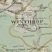
Winthrop GIS Mapping
Town of Winthrop - CAI Technologies |
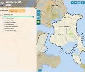 |
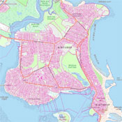
MassMapper
Commonwealth of Massachusetts - MassGIS |
 |
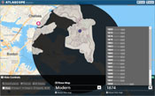
Atlascope Boston
Winthrop maps - Boston Public Library |
 |
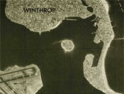
U.S. Geological Survey
- USGS TopView
Map avialble for selected years between 1892 and 2024 |
 |
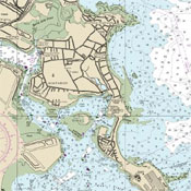
NOAA Charts
- NOAA Office of Coastal Survey |
 |
| |
|
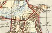
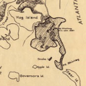
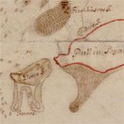
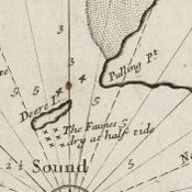
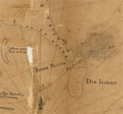
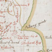
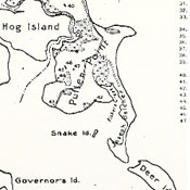
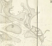
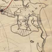
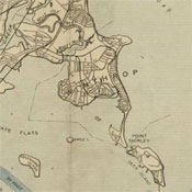
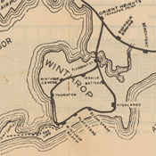
Winthrop - Anciently Pullin Point - 1624
Channing Howard, 1920 - Norman B. Leventhal Map Center,
Boston Public Library |
 |
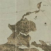
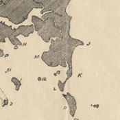
The Winthrop Map - Circa 1633
History of America, Justin Winsor, Volume 3, pg. 381, 1886 - Internet Archive |
 |
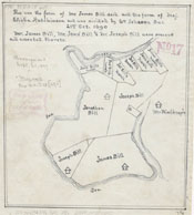
The Fifteen Original Owners of Winthrop - 1637
Sidvin F. Tucker, 1952 - Internet Archive | Beacon Photography and Framing |
 |
This Harbour of Boston - 1688
Phillip Wells, Massachusetts Historical Society, 1688 - Norman B. Leventhal Map Center,
Boston Public Library |
 |
Boston Harbor in New England - 1689
Southack, Cyprian, 1689 - Norman B. Leventhal Map Center,
Boston Public Library |
 |
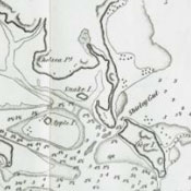
Winthrop in 1690
Sidvin F. Tucker, 1952 - Internet Archive |
 |
Plan of farm lands in Chelsea belonging to the Bill family, 1690
Norman B. Leventhal Map Center,
Boston Public Library |
 |
Carte de la ville, baye et environs de Baston
Jean Baptiste Fraquelin, 1693 - Norman B. Leventhal Map Center,
Boston Public Library |
 |
A Draught of Boston Harbor
Fitzhugh, Augustine, Southack, Cyprian, 1694 - Norman B. Leventhal Map Center,
Boston Public Library |
 |
An Exact Draught of Boston Harbor with a Survey of Most of the Islands, 1711
A documentary history of Chelsea: including the Boston precincts of Winnisimmet, Rumney Marsh, and Pullen Point, 1624-1824, 1908 - Wikipedia |
 |
Chelsea, 1739
A documentary history of Chelsea: including the Boston precincts of Winnisimmet, Rumney Marsh, and Pullen Point, 1624-1824, 1908 - Wikipedia |
 |
Manuscript Map of the Boston Harbor, 1775
Jeremy Belknap, 1775 - Massachusetts Historical Society |
 |
Boston, its Environs and Harbour, with the Rebels Works Raised Against That Town in 1775
Sir Thomas Hyde, 1775 - Library of Congress |
 |
Boston, its Environs and Harbour, with the Rebels Works Raised Against That Town in 1775
Sir Thomas Hyde, 1775 - Library of Congress |
 |
Boston With its Environs, 1775 & 1776
Richard Frothingham, 1849 - Digital Commonwealth, Salem State University |
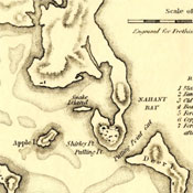 |
Chart of Boston Harbor - 1781
Joseph F.W. Des Barres, 1781 - Norman B. Leventhal Map Center,
Boston Public Library |
 |
Boston With its Environs, 1806
Caleb Parry Wayne, 1806 - Norman B. Leventhal Map Center,
Boston Public Library |
 |
Boston With its Environs, 1806
R. Phillips, 1806 - Norman B. Leventhal Map Center,
Boston Public Library |
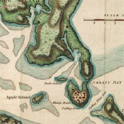 |
Chart of Boston Harbour: Surveyed in 1817
Alexander W Wadsworth, William Bainbridge, 1819 - Norman B. Leventhal Map Center,
Boston Public Library |
 |
Boston Harbour, From the Survey of A.S. Wadsworth, Esq., U.S.N. and the Chart of Des Barres - 1847
E. Blunt & G.W., 1847 - Norman B. Leventhal Map Center,
Boston Public Library |
 |
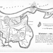
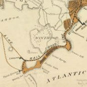
Winthrop in 1852
Sidvin F. Tucker, 1952 - Internet Archive | Beacon Photography and Framing |
 |
Map of Boston Harbor Showing Commissioners' Lines, Wharves & C. - 1852
Chesbrough, Ellis Sylvester, 1852 - Norman B. Leventhal Map Center,
Boston Public Library |
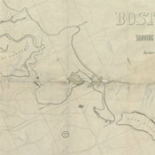 |
Map of Boston and its Vicinity - 1859
Henry Francis Walling, 1859 - Norman B. Leventhal Map Center,
Boston Public Library |
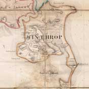 |
Chart of Boston Harbor and Massachusetts Bay: With Map of the Adjacent Country - 1861
E. P. Dutton & Co., 1861 - Norman B. Leventhal Map Center,
Boston Public Library |
 |
Boston Harbor, Massachusetts - 1863
Alexander Dallas Bache, 1863 - Norman B. Leventhal Map Center,
Boston Public Library |
 |
Map of Boston (As it should be) and the Country Adjacent, With Proposed Harbor Improvements, Etc. - 1867.
E.P. Dutton & Co., 1867 - Norman B. Leventhal Map Center,
Boston Public Library |
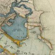 |
Chart of Boston Harbor, From the Best Authorities - 1873
Nathaniel S. Dearborn, 1873 - Norman B. Leventhal Map Center,
Boston Public Library |
 |
J. Schedler's Relief Map of Boston and Environs - 1874
Joseph Schedler, 1874 - Norman B. Leventhal Map Center,
Boston Public Library |
 |
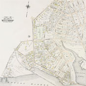
Atlas of the county of Suffolk, Massachusetts, vol. 4: including East Boston, city of Chelsea, Revere and Winthrop - 1874
G.M. Hopkins & Co., 1874 - State Library of Massachusetts, Flickr |
 |
Map of Boston and the Country Adjacent, Showing Rural Parks - 1874
Ernest W. Bowditch, 1874 - Norman B. Leventhal Map Center,
Boston Public Library |
 |
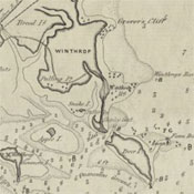
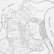
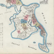
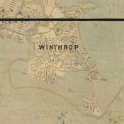
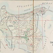
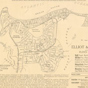
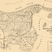
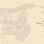
Map of the Town of Winthrop, Mass. - 1876
- Beacon Photography and Framing |
 |
Map Showing Horse Rail Roads and the Surface Steam Roads with 104 Stations in and around Boston, Including 91 Surface Steam R.R. Stations - 1876
J.H. Bufford's Sons, 1876 - Norman B. Leventhal Map Center,
Boston Public Library |
 |
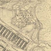
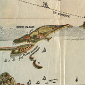
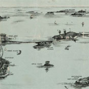
Balloon view - Boston Harbor - 1879
F. Kimball Rogers, John H. Daniels, 1879 - Norman B. Leventhal Map Center,
Boston Public Library |
 |
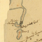
Map of the Eastern Junction Broad Sound Pier, & Pt. Shirley Railroad Steamboat Lines and Connections, Established for the Purpose of Developing the Most Popular Seashore Resort on the Atlantic Coast - 1880
Whitman & Breck; 1880 - Norman B. Leventhal Map Center,
Boston Public Library |
 |
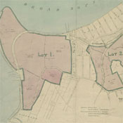
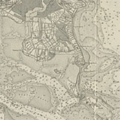
Plan of Winthrop Farm in the Town of Winthrop belonging to the City of Boston - 1882
Thomas W. Davis, 1882 - Norman B. Leventhal Map Center,
Boston Public Library |
 |
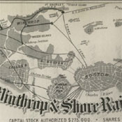
Stock Certificate for the Boston, Winthrop & Shore Railroad Company - 1885
1885 - Wikimedia Commons |
 |
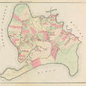
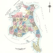
Atlas of the City of Chelsea and the Towns of Revere and Winthrop, Massachusetts - 1886
G.W. Bromley and Co., 1886 - State Library of Massachusetts, Flickr |
 |
Plan showing location of the proposed branch of the Boston, Winthrop and Shore Railroad in the town of Winthrop, Mass. - 1886
Whitman & Breck, 1886 - State Library of Massachusetts, Digital Commonwealth |
 |
Boston, Mass. Parks and Recreation Dept. - 1888
Parks and Recreation Dept., 1888 - Norman B. Leventhal Map Center,
Boston Public Library |
 |
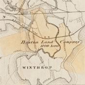
Plan of Estate of the Boston Land Co. and Surrounding - 1889
Whitman & Breck, 1880-1889 - Norman B. Leventhal Map Center,
Boston Public Library |
 |
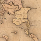
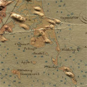
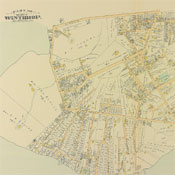
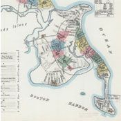
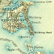
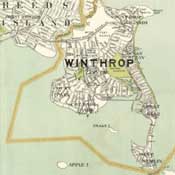
Map of Winthrop - 1890
Floyd & Tucker, 1890 - Beacon Photography and Framing |
 |
Atlas of Massachusetts - 1891
Geo. H. Walker & Co., 1891 - State Library of Massachusetts, Flickr |
 |
U.S. Geological Survey, Boston Bay, 1:62,500 - 1892
U.S. Geological Survey, 1892 - USGS TopView |
 |
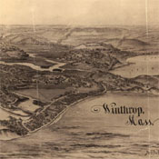
Bird's-eye-view of Winthrop, Mass. - 1894.
A.F. Poole, 1894 - Library of Congress |
 |
Sanborn Insurance Maps of Revere & Winthrop, Massachusetts
Sanborn-Perris Map Co., 1891 - Library of Congress |
 |
Sanborn Insurance Maps of Revere & Winthrop, Massachusetts
Sanborn-Perris Map Co., 1896 - Library of Congress |
 |
Atlas of the City of Chelsea and the Towns of Revere and Winthrop, Massachusetts: From Actual Surveys and Official Plans
G.W. Bromley and Co., 1896 - State Library of Massachusetts, Flickr |
 |
Winthrop Steamboat Co. Routes
George. H. Walker & Co., 1896 - Norman B. Leventhal Map Center,
Boston Public Library |
 |
Map of Chelsea, Everett, Revere, & Winthrop
George. H. Walker & Co., 1897 - Norman B. Leventhal Map Center,
Boston Public Library |
 |
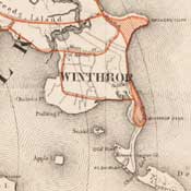
Atlas of the Boundaries of the Town of Winthrop, Suffolk County, 1898
Topographical Survey Commission - State Library of Massachusetts |
 |
Map of Boston Harbor
George. H. Walker & Co., 1899 - Norman B. Leventhal Map Center,
Boston Public Library |
 |
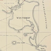
U.S. Geological Survey, Boston Bay, 1:62,500
U.S. Geological Survey, 1903 - USGS TopView |
 |
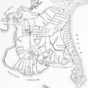
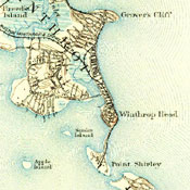
Map of Winthrop, 1903 Boston Revere Beach and Lynn Railroad Winthrop Loop
Floyd & Tucker, 1903 - Wikipedia |
 |
Boston Yacht Club - 1903
Boston Yacht Club, 1903 - Norman B. Leventhal Map Center,
Boston Public Library |
 |
Atlas of the towns of Revere and Winthrop, Suffolk County, Massachusetts - 1906
Whitman & Howard, 1906 - State Library of Massachusetts, Flickr |
 |
Boston Harbor, Massachusetts - 1906
U.S. Coast and Geodetic Survey, 1906 - Digital Commonwealth, Salem State University |
 |
Plan for a New Port for Boston - 1909
Commission on Metropolitan Improvements, 1909 - WardMaps |
 |
Map of Boston and Suburbs - 1913
Walker Lith. & Pub. Co, 1913 - Norman B. Leventhal Map Center,
Boston Public Library |
 |
Boston Harbor & Vicinity - 1913
Massachusetts, Directors of the Port of Boston, 1913 - Norman B. Leventhal Map Center,
Boston Public Library |
 |
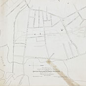
Map of Winthrop Made by Whitman & Howard for Floyd and Tucker - 1913
Whitman & Howard, 1913 - WardMaps |
 |
Atlas of the City of Chelsea and the Towns of Revere and Winthrop, Massachusetts - 1914
G.W. Bromley and Co., 1914 - State Library of Massachusetts, Flickr |
 |
Bird's eye view of Boston Harbor along the South Shore to Plymouth, Cape Cod Canal, and Provincetown - 1920
Union News Company, 1920 - Digital Commonwealth, Salem State University Archives and Special Collections |
 |
Winthrop - Anciently Pullin Point - 1624
Channing Howard, 1920 - Norman B. Leventhal Map Center,
Boston Public Library |
|
Atlas of Massachusetts
Walker Lithograph & Co., 1922 - State Library of Massachusetts, Flickr |
 |
Boston Harbor
George H. Walker & Co., 1923 - Norman B. Leventhal Map Center,
Boston Public Library |
 |
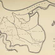
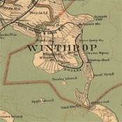
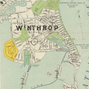
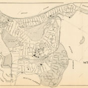
Map of the Town of Winthrop, Mass. Showing Precincts, 1931
Whitman & Howard, 1931 - WardMaps |
 |
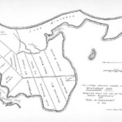
Zoning Plan of the Town of Winthrop, Mass., 1937
Whitman & Howard, 1937 - WardMaps |
 |
Map of Boston Revere Beach & Lynn R.R.
1939 - Wikipedia |
 |
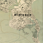
Map of the Town of Winthrop, Massachusetts, 1942
Sidvin F. Tucker, 1942 - WardMaps |
 |
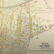
Sanborn Fire Insurance Map from Winthrop, Suffolk County, Massachusetts
Sanborn Map Co., 1954 - Library of Congress |
 |
| |
Top |
_(14598006967).jpg)
_(14761536926).jpg)


