| File # |
2247 |
| Title |
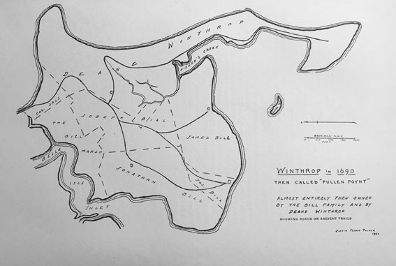
Map of Winthrop in 1690 |
| Description |
Winthrop in 1690. “The called Pullen Poynt” – Almost entirely then owned by the Bill family and Deane Winthrop. Showing roads or ancient trails. Sidvin Frank Tucker 1952 |
| Date |
1952 |
| Format |
JPEG |
| Location |
Winthrop Public Library & Museum |
| Collection |
William H. Clark, History of Winthrop |
|