| File # |
2250 |
| Title |
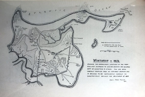
Map of Winthrop 1852 |
| Description |
Winthrop in 1852. Shows the approximate location of the then dwellings according to U.S. Gov. surveys and records left by Lucius Floyd & others. This has been carefully compiled from all available sources and is believed to be sufficiently correct to substantially reflect the Winthrop of 1852. Sidvin Frank Tucker 1952. |
| Date |
1952 |
| Format |
JPEG |
| Location |
Winthrop Public Library & Museum |
| Collection |
William H. Clark, History of Winthrop |
| Collection |
Beacon Photography |
|